menu
menu


Sail safe

Save money

Discover new places

Preserve your memories
![]() is the best navigation application for Masurian sailors. The most accurate nautical charts were created specifically to cover your needs. We have created innovative features to make sailing even more comfortable and safe.
is the best navigation application for Masurian sailors. The most accurate nautical charts were created specifically to cover your needs. We have created innovative features to make sailing even more comfortable and safe.
![]() is an irreplaceable application to find the right direction on the Masurian Lakes.
is an irreplaceable application to find the right direction on the Masurian Lakes.
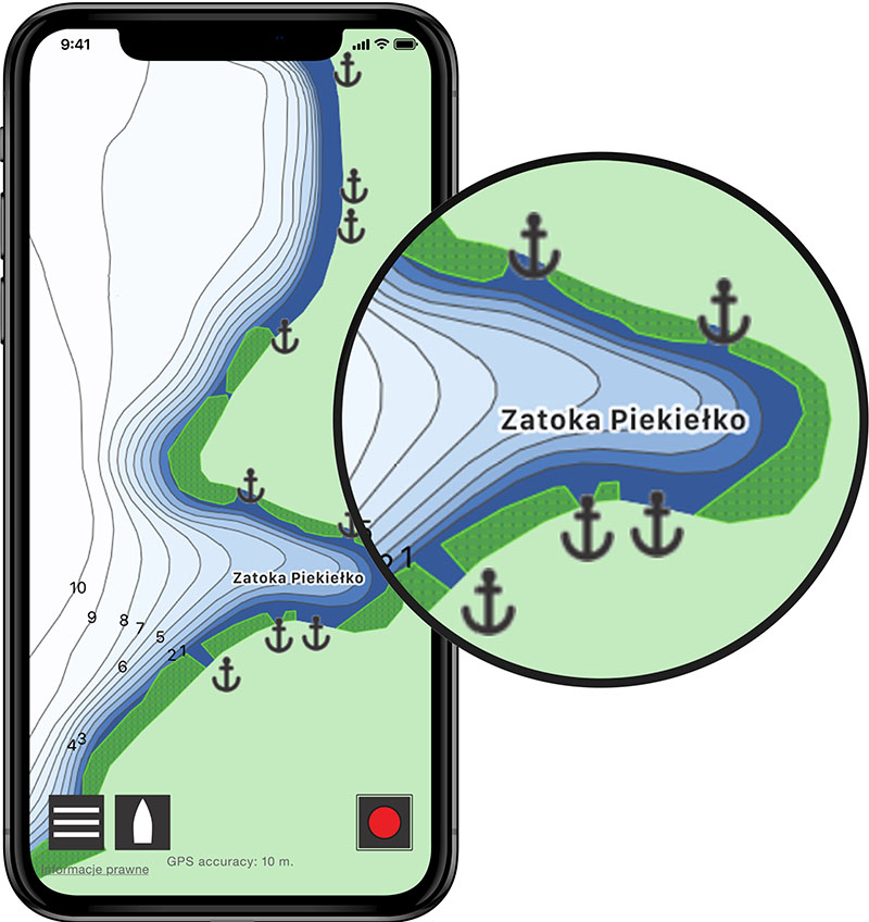
Taider contains the best bathymetric charts, made on the basis of newest bathymetric surveys. Our charts cover all of the Great Masurian Lakes and are very clear and intuitive in usage. Having them makes you able to sail even during the night or in the fog. On Taider charts you will find all necessary information like depth, ports layouts, jetty locations, moorage spots, silence zones, reeds, forests and buildings. Despite that, our charts are small (only 2,0 MB), and are downloaded only once and keept in your device memory to save data transmission.
Bathymetric charts of lakes currently available in Taider app: Bełdany, Boczne, Bodma, Dargin, Dobskie, Guzianka Mała, Guzianka Wielka, Jagodne, Kirsajty, Kisajno, Łabap, Mamry, Mikołajskie, Nidzkie, Niegocin, Popówka Wielka, Przystań, Roś, Ryńskie, Seksty, Sztynorckie, Szymoneckie, Śniardwy (Bramka Sekstyńska), Święcajty, Tajty, Tałtowisko, Tałty, Warnołty. More lakes soon.
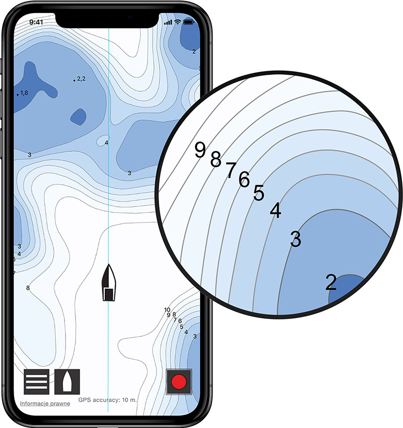
Taider's charts contains even that shallow places and stone reefs which have not been marked with buoys on the water. When sailing on Masurian Lakes, you don’t have to be limited by lateral marks. Feel safe and free to sail across all the Great Masurian Lakes.
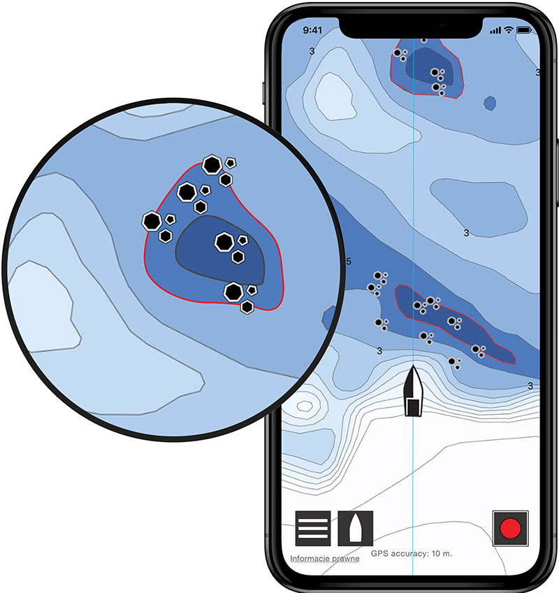
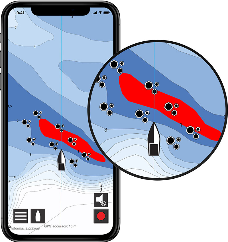
Taider has an innovative warning system. You don’t have to frequently check your position on the map. Taider will warn you about nearby hazards by emitting a sound signal, and give you the time to correct your course.
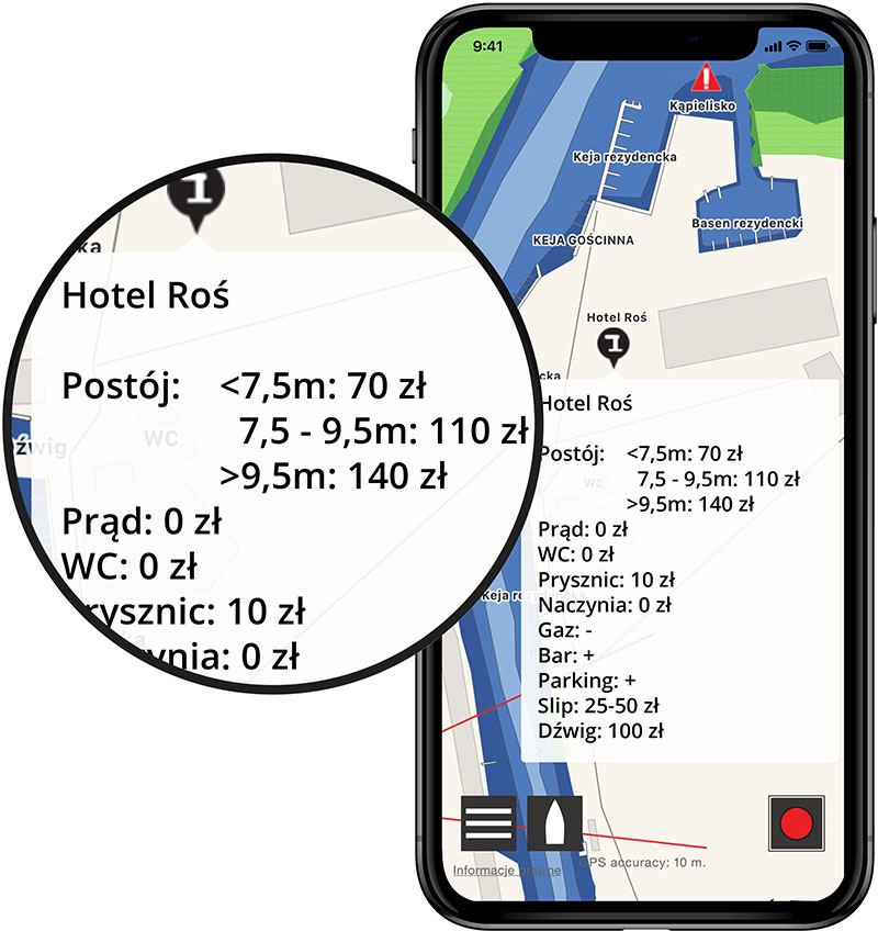
Wonder which port fits your needs? By clicking  , information about available infrastructure will be displayed.
Please note that Taider only aggregates price lists from available sources. Actual prices and services available at ports may vary and are determined and changed by the managers on an ongoing basis.
Masurian Lakes show their true beauty away from loud and crowded ports. Taider will show you all the best places for mooring at the shore.
Before you sail on a cruise, click  . Your current speed and trail will be shown, and Taider will start recording the trail. After returning from a cruise, you can recall memories by replaying the route you have traveled on eg. using Google Earth.

'Absolutely the best nautical charts I have ever used.'
David
'Collision alert saved us from stress and loss of deposit!'
Przemek
'Thanks to Taider we stopped sticking to the same trail and started to discover places we didn't know before.'
Magda
'We won the regatta! Thanks to Taider's charts we did a maneuver that bring us victory.'
Greg

Point objects
Lateral marks, region A. Masurian Lakes trails are marked from north to south and from west to east.
Cardinal marks - indicates the position of a hazard and the direction of safe water. Please take attention - sometimes buoys can be in incorrect position on the water, e.g. swapped sides.
Areas
Linear objects
The charts were prepared on the basis of bathymetric surveys performed by our company and they are the most accurate available on the market. On our charts you will find:
Current prices can be found by one click in the app. You can use Taider from PLN 0.68 a day.
Bathymetry of the southern and eastern part of Lake Śniardwy is now available in the Taider app. Surveys will be continued in 2024, and the charts will be systematically updated.
The water level for Taider is the average water level in the Great Masurian Lakes system: 115 cm - on the water level gauge in Giżycko, 140 cm - on the water level gauge on Lake Przystań, 100 cm on the water level gauge in Maldanin (Lake Roś). If on the above mentioned water level gauges, current readings are higher than the given average, you should add that difference to the Taider map readings.
If the water level is lower than given averages, then such a difference should be subtract from the map readings. The water level in the GML system is usually higher at the beginning of the season and lowest at the end of the season. The biggest water level drops occur on the Lake Roś.
Feel free to contact us via email: biuro [at] taider.pl
Wpis do rejestru przedsiębiorców Krajowego Rejestru Sądowego pod numerem KRS 0000 423 689, prowadzonego przez Sąd Rejonowy dla m. st. Warszawy, XII Wydział Gospodarczy Krajowego Rejestru Sądowego. Kapitał zakładowy 100.000 PLN, NIP: 701-034-52-01